As of Monday, Dexter was located about 275 miles north-northwest of Bermuda with sustained winds of 45 mph, according to the National Hurricane Center (NHC). The storm is moving east-northeast and is not expected to impact the US mainland directly.
Also read: New Orleans under flood watch as tropical system could trigger a month’s worth of rain. What should you do
Forecasters say stronger wind shear will likely weaken Dexter in the coming days. However, its presence may still generate high surf and rip current risks along the East Coast throughout the week.
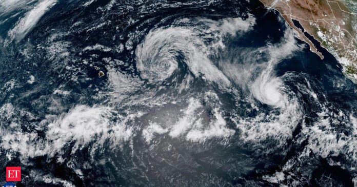
Tropical Storm Henriette forms in eastern Pacific
While Dexter continues to move away from land, Tropical Storm Henriette formed in the eastern Pacific on Monday. The storm was centered about 895 miles southwest of the southern tip of Mexico’s Baja California Peninsula.Henriette also had maximum sustained winds of 45 mph and was moving west-northwest at 15 mph. The NHC stated that no coastal watches or warnings are in effect. Forecast models indicate Henriette may strengthen slightly over the next 48 hours, but it is not expected to pose any threat to land.Both storms represent the growing activity across tropical basins as the peak of hurricane season approaches in August and September.
Two Atlantic areas being monitored for development
In addition to Dexter, the National Hurricane Center is monitoring two other systems for possible tropical development in the Atlantic Basin.
1. Southeast US coast:
A new area of low pressure may develop later this week along the same stalled frontal boundary that produced Dexter. The system could organize gradually mid- to late-week as it moves northwest toward the Carolinas. The disturbance could enhance showers and thunderstorms along the Southeast coast, where wet conditions have already begun early this week.
2. Eastern Atlantic tropical wave:
A tropical wave that emerged off the coast of Africa is also being monitored for development. Forecasters indicate it could become a tropical depression or storm later this week as it travels through the central Atlantic. It currently poses no immediate threat to land, but its path will be tracked over the coming days.
Should either of these systems strengthen into named storms, the next names on the Atlantic list are Erin and Fernand.
Peak hurricane season conditions taking shape
The National Hurricane Center notes that the next four to six weeks historically bring a sharp increase in tropical storm activity across the Atlantic Basin. Key contributing factors include peak sea surface temperatures, lower wind shear, reduced Saharan dust, and greater atmospheric instability, all of which support tropical cyclone formation.
Development areas during this period typically range from the Gulf of Mexico and US Southeast to the central Atlantic and areas near the Lesser Antilles. Forecast models and historical patterns suggest the potential for additional named storms in both basins as August continues.
Residents and coastal communities are advised to monitor official forecasts and remain prepared as tropical systems continue to emerge in the coming weeks.

